 The graph shows the trajectories of the two satellites on 2009-02-10 obtained from the TLEs and SGP4. The solid plots are the satellites position projected on the Earth's surface (latitude and longitude), while the dashed plots are the magnitude of the radius vector (right vertical axis).
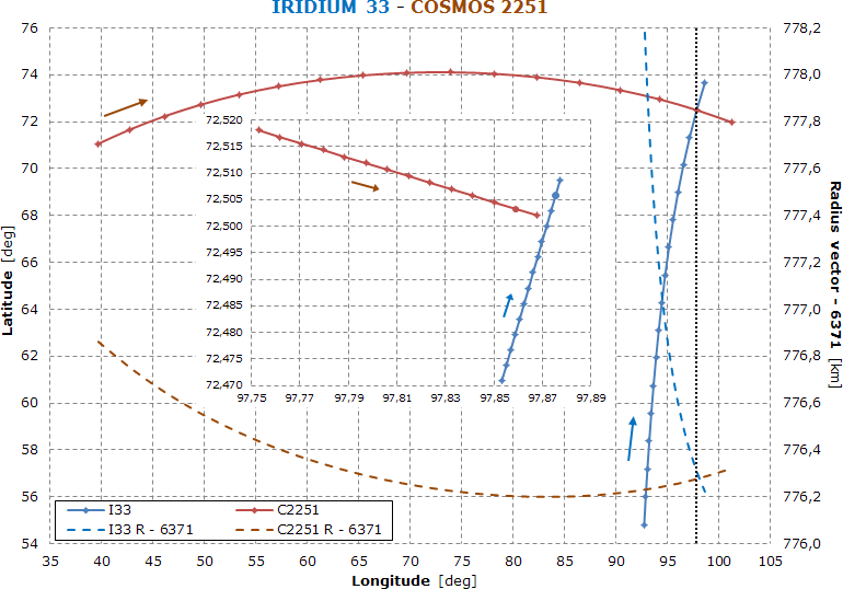
The dots in the main graph are plotted with a time step of 20 s, while those in the inset are plotted every 50 ms and the two filled circles represent the closest approach.
According to the TLEs, the time of the closest approach is 2009-02-10 16:55:59.808 with a minimum distance of 834 m and a relative speed of 11.6 km/s.
For an exhaustive analysis, see celestrak.com.